Aerial Imagery: Aerial Imaging Solutions

THE LEADING PROVIDER OF AERIAL IMAGING SOLUTIONS

Does your project demand intricate mapping and precise measurements of a specific geographic area? L3Harris provides accurate, reliable aerial imaging solutions to help clients address their most challenging geospatial problems.

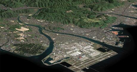
Aerial imagery, captured from airborne craft at lower altitudes, offers significantly higher accuracy and detail than satellite imagery. Users can also acquire aerial imagery on-demand for real-time analysis, customize perspectives and viewing angles, and target particular areas to avoid unnecessary imaging — saving valuable time and reducing costs.  

Whether you're analyzing a region or a specific site, our aerial imaging solutions will transform your data into actionable insights.   


“L3Harris imagery is fundamental in the creation of visual databases for our simulator. The imagery provided allows for the accurate placement of custom 3D objects to create a fully immersive training environment.” - Wing-Chiu Choi, ATC Specialist - UFA, Inc.

Aerial Imagery

Hexagon logo


L3Harris proudly distributes aerial imaging solutions from the Hexagon Imagery Program (HxIP). This technology uses today’s most advanced airborne sensors to capture high-quality, orthorectified imagery. Features include:

  • 15-cm/6-in Resolution for Urban Area Coverage
  • 30-cm/1-ft Resolution for Wide Area Coverage
  • 4-Band (Red, Green, Blue, & Near-Infrared) Data  
  • Set Specifications and Accuracy Standards  
  • Metadata  
  • Planned Refresh Schedule 

Coverage: United States and Western Europe 
Resolution: 15-30 cm  
Band: Natural color, 4-band  
Projection: UTM, Lat/Long, State Plane  
Datum: NAD 27, 83, WGS 84  
Dates: 2014 — present 

Sample data available upon request

  • Hexagon 30 cm — 14.1 MB
  • Hexagon 15 cm — 21.5 MB
  • Hexagon 05 cm


Request A Quote


Instant Imagery

Instantly stream and download high-resolution aerial imagery with a resolution of 6 inches for any of the areas below that are featured in the HxGN Content Program. Or, use our online imagery portal to quickly access imagery for small sites in the United States and Western Europe.  

sas-geospatial-hex-6in-imagery

You can access the portal by setting up an account here.  Once you set up your account, visit the Imagery Portal to upload or outline your project area, purchase data, and download it within minutes. Please note larger files may take longer to download.

If you need newer data not found on the portal, please contact us today through the "Request A Quote" button.

Aerial Imagery Services

Visualize any area in North America with our fully integrated aerial digital topographic map services. Our suppliers’ fleets of aircraft equipped with the latest digital mapping cameras, airborne GPS, and inertial measurement systems to capture accurate, reliable site data you can trust. With a staff of expert photogrammetrists, imaging specialists, programmers, and technicians at the helm, we are uniquely qualified to meet the most challenging project and budgetary requirements in any industry.

Photogrammetry is the science of measuring and mapping points on the ground from several digital or hard copy photographs taken from different airborne perspectives.  

With aerial photogrammetry, users stitch these images together to create accurate, precisely detailed 3D representations of the topography and objects in a given area. Typical outputs include planimetric feature maps, contour line maps, and Digital Terrain Models. Planimetric feature maps show visible features on a flat surface, contour line maps display elevation changes, and Digital Terrain Models give a 3D representation of the Earth's surface — all instrumental in applications ranging from land surveying to urban planning and construction management.

Aerial photogrammetry’s many advantages include: 

Aerial Survey Collection
  • Superior spatial accuracy: Our imagery specialists calibrate focal length, principal point coordinates, and various forms of lens distortion to identify and correct systematic flaws in imagery data. 
  • Rigorous insights: High-resolution aerial maps and imagery provide the necessary perspective to resolve disputes other technologies might produce.  
  • Flexibility: Photogrammetry is a customizable aerial imaging solution. Based on a project’s requirements, we use metric film cameras to acquire panchromatic, natural color, or color-infrared aerial photographs and digital metric cameras to acquire multispectral digital imagery.
  • Historical Value: Aerial photogrammetry is ideal for documenting and preserving cultural heritage, archaeological sites, or changing landscapes in digital format.  
  • Efficiency & Cost-Effectiveness: Aerial photogrammetry leverages the power of computer algorithms to create 3D models faster and more affordably than manual methods.  
  • Pectral digital imagery can be acquired from digital metric cameras. 

From working with aerial companies to produce the most efficient collection flight path, to choosing the appropriate aerial sensor for the task, a dedicated project lead will help you define your scope of work and ensure the entire project's success. 

Aerial Survey Collection

The key to a successful aerial survey is accurately referencing the captured aerial imagery to ground control points, which must be visible in the aerial image data.

To provide superior coverage and meet horizontal and vertical accuracy requirements, we design the layout and placement of control points within your project area. We collect control points for most aerial projects unless directed otherwise — ensuring that every facet of your design is accurate and reliable.  

Terms & Conditions

  • Event Placeholder Banner

    Data & Imagery Products Policies

Related capabilities

Related News

L3Harris Nexus

Press release | 12. 06. 2024

L3Harris Awarded Grants for New Buildings in Florida

L3Harris Technologies has negotiated a High Impact Business Performance (HIPI) grant for $2 million from the state of Florida.

L3Harris Nexus

Press release | 12. 06. 2024

L3Harris Awarded Grants for New Buildings in Florida

NASA Roman Space Telescope

Press release | 11. 14. 2024

L3Harris Delivers Optical System to NASA for Nancy Grace Roman Space Telescope

Satellite hovers over battlefield and tracks threats

Editorial | 11. 14. 2024

L3Harris’ First Infrared Payload Ready for Space Vehicle Integration Under SDA Missile Defense Program

Himawari-10 satellite rendering. Thumbnail image. Copyright Mitsubishi Electric Corporation

Editorial | 11. 12. 2024

United Against the Storms

L3Harris’ Fifth Cross-Track Infrared Sounder Complete and Ready for NOAA Weather Satellite Integration image thumbnail

Editorial | 10. 07. 2024

L3Harris’ Fifth Cross-track Infrared Sounder (CrIS) Complete and Ready for NOAA Weather Satellite Integration

Related Domains & Industries

Solutions that solve our customers' toughest challenges.
view all capabilities