
Weaver

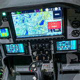
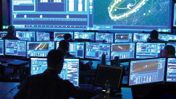
Weaver is a situational awareness and mission management software application built to enable operators with tools for more effective crew coordination and improved mission execution. 

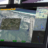
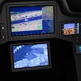
The intuitive user interface allows operators to customize their displays to support mission need with dynamically resizable media windows that display maps, video, or augmented reality video. A floating media panel allows dual-screen operation. Additionally, each window displays tactical information such as range and bearing between tracks, sensors, and the map cursor with built-in distance measuring and annotation tools. 

Points of interest are imported in multiple common formats including KML and KMZ files from Google Earth. Track data is displayed on the maps and augmented reality video from multiple sources including sensor metadata, or via datalink in Cursor-on-Target format. 

Weaver is out-of-the-box compatible with L3Harris WESCAM MX™-Series EO/IR sensors and industry-standard maps and charts. It is easily adaptable to additional platforms and mission sets via existing plug-ins or custom interfaces. These include the ability to access video recording functions, system interfaces, such as EO/IR sensors, radars, radios, helmet mounted cueing systems (HMCS), heads up displays (HUD), special intelligence payloads, video recorders and others.

In addition, L3Harris provides options for tailored support and training.

Unable to view the experience above? Click Here to launch in a new tab.

Resources

  • Weaver Data Sheet

    Weaver Data Sheet

Related News

FNSS Kaplan20 with L3Harris WESCAM MX™-GCS

Editorial | 02. 14. 2025

Four Ways L3Harris Targeting and Sensor Systems are Defining the Future of Land Missions

The future of electro-optical/infrared (EO/IR) land systems is evolving at the edge with new advancements in stability, reliability, ruggedness, counter-UAS Capability and integration of hardware and software are increasing our capabilities for complete situational awareness, faster threat identification, effective engagement.

FNSS Kaplan20 with L3Harris WESCAM MX™-GCS

Editorial | 02. 14. 2025

Four Ways L3Harris Targeting and Sensor Systems are Defining the Future of Land Missions

Autonomous Swarms

Press release | 02. 10. 2025

L3Harris Launches New Technology to Control Autonomous Swarms

Critical maritime operational requirements across riverine, littoral and blue water environments

Editorial | 01. 09. 2025

Critical EO/IR Requirements in Maritime Special Operations

Worker types on laptop while looking out airplane window

Editorial | 12. 17. 2024

L3Harris Completes Successful Demonstration with Startup to Deliver AI-Enabled Solutions

L3Harris Equips New German H145M Helicopters with High-Performance Imaging Capabilities

Press release | 12. 09. 2024

L3Harris Equips New German H145M Helicopters with High-Performance Imaging Capabilities

Related Domains & Industries

Solutions that solve our customers' toughest challenges.
view all capabilities
Contact Us