Nothing about 2020 was normal. As the U.S. was in the throes of a global pandemic, it also endured 22 separate billion-dollar weather and climate disasters.
2020’s record-setting hurricane and tropical storm season, coupled with devastating wildfires in the West, shattered expectations about what a “normal” season might look like. There were so many hurricanes last year, meteorologists ran out of storm names. The National Oceanic and Atmospheric Administration (NOAA) resorted to using hurricane names from the Greek alphabet, only the second time in history this back-up plan has ever been used. Unfortunately, climate change continues to play a role in increased storm intensity and unpredictability, further underscoring the urgency and importance of advancing forecasting technology.
“The 2020 Atlantic hurricane season ramped up quickly and broke records across the board,” said acting NOAA administer Neil Jacobs in a NOAA press release. “Our investments in research, forecast models and computer technology allowed forecasters at the National Weather Service, and its National Hurricane Center, to issue forecasts with increasing accuracy, resulting in the advanced lead time needed to ensure that decision makers and communities were ready and responsive.”
This video looks at advances in hurricane forecasting, with a focus on the contributions from weather satellites. Credits: NASA/ Jefferson Beck
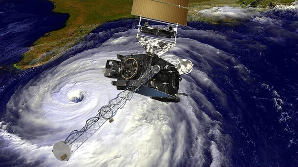
Every weather satellite launch represents additional preparation time between dangerous weather and its impending impact on lives, critical infrastructure and property. NOAA’s Joint Polar Satellite System (JPSS) and Geostationary Operational Environmental Satellites-R (GOES-R) Series are the most advanced weather satellite constellations ever flown and its imagery and data are invaluable to forecasters. Now, as NOAA looks to build their next-generation weather satellite architecture, it presents an exciting opportunity to elevate their already impressive forecasting capabilities.
In order to stay ahead of the impacts of climate change on severe weather, L3Harris is investing in new approaches to weather imaging, sounding and ground systems capabilities. Using L3Harris’ Advanced Baseline Imager (ABI) in geostationary orbit (GEO), NOAA is able to constantly scan the same area for weather hotspots with less lag time than other orbits. By adding a hyperspectral infrared sounding capability, forecasters could identify even the smallest indicator that inclement weather is on the way, like water vapor pooling, convection and even heat. Additionally, L3Harrris is developing a scalable, cloud-enabled ground system to support the increasing volumes of data and imagery NOAA’s future constellation will produce. By layering these technologies together, forecasters will have seamless access to the most advanced, accurate and detailed weather products needed to quickly and persistently provide advanced warnings.
As hurricanes become more intense, fires more rampant and tornadoes more prolific, every extra minute, hour or day residents have to prepare is precious. Studies have shown that a hyperspectral infrared sounder in GEO has the potential to predict tornado formation up to six hours before touchdown. This life-changing capability would make it less likely for residents to be caught-off guard and left unprotected. This same technology could also help National Hurricane Center reduce forecast errors, provide more accurate timelines to hurricane landfall and more reliable path and intensity predictions. The more trust people have in forecasting, the more likely they are to make confident decisions to seek shelter or evacuate.
With the threat of climate change constantly looming, it’s imperative to continually evolve weather satellite technology and insert new sensors to fill current gaps. L3Harris is committed to solving future problems that unpredictable weather will pose by layering together new technology. Deploying a hyperspectral infrared sounder in GEO, advancing ABI technology and developing cloud-enabled ground systems that can cost effectively handle future data needs will arm forecasters with the capabilities necessary to creating a more weather resilient nation.
