Predicting Environmental Disasters Begins in Space


Hurricane Ian shattered records, homes and lives in late September of 2022 as it pummeled Florida’s western coast with intense winds, heavy rainfall and catastrophic storm surges.

The hurricane, which roared ashore just west of Fort Meyers at speeds of 150 mph, was one of the most powerful storms to hit the U.S. in decades. It was also one of the deadliest.

Of all the severe weather events tied to Hurricane Ian, like the extreme winds, intense rainfall, landslides and tornadoes, the most unexpectedly devastating for the residents of the Gulf Coast were the storm surges and flooding.

As Ian made landfall in Florida, water from the Gulf of Mexico pushed as high as 18 feet above the normal dry ground – a surge more than double what was anticipated.

The unprecedented storm surge left many wading through their homes in search of higher ground. Some even found themselves trapped inside their homes.

When it comes to environmental disasters like hurricanes, flash floods, tornadoes, blizzards and forest fires – every second counts.

Disaster Strikes

Gulf Coast residents found themselves in a very dangerous and potentially life-threatening situation as a result of the storm surge and a “1-in-1000-year” amount of rainfall (17 inches of rain within 24 hours).

Weather Satellites: Keeping an Eye on Severe Weather from Space

How do we increase warning times and improve the accuracy of forecasting models in the face of severe and complex weather events, like Hurricane Ian, which become deadlier and costlier each year?

The answer is through an advanced, multilayered architecture of weather satellite technology distributed across geostationary orbit (GEO) and low Earth orbit (LEO) – serving as meteorologists’ “eyes in the sky.”

In fact, data from weather satellite technology, like L3Harris’ Advanced Baseline Imager (ABI) and Cross-Track Infrared Sounder (CrIS), is already being used to help inform forecasting models and provide life-saving severe-weather warnings.

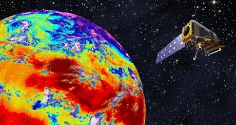
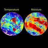
During hurricanes, CrIS is collecting 3D temperature and moisture profiles from each layer of the atmosphere on board NOAA’s Joint-Polar Satellite Systems (JPSS). This data is then used by National Oceanic and Atmospheric Administration (NOAA) to predict storm intensity, rainfall and trajectory.

ABI is also used to keep people informed and protected during extreme weather events. To stay ahead of developing storms, ABI, aboard the NOAA Geostationary Operational Environmental Satellite-R (GOES-R) Series, delivers rapidly refreshed infrared imagery with 4x the spatial resolution of the previous generation near real-time including severe storm data every 30 seconds.

All of this information helps meteorologists predict the potential impacts of extreme weather and the areas that are likely to be affected. 

Together, CrIS (on JPSS) and ABI (on GOES-R) provide critical severe-weather-tracking data to keep those in harm’s way armed with the latest information and warnings.

For over 50 years, L3Harris has been at the forefront of advancing weather satellite capabilities to improve the accuracy of weather forecasts, measure climate change and increase life-saving warning times.

A New Era of Weather Forecasting

The nation's existing space assets have been transformative for weather observation. But to keep pace with the ever-evolving threat of extreme weather, we must continue our relentless pursuit to evolve NOAA's next-generation weather architecture.

The Next Generation of Weather Readiness: NOAA’s GeoXO and LEO Constellations

The good news is that NOAA is already hard at work mapping out and developing this evolved architecture, which will enable faster and more accurate global coverage of evolving weather events.

It’s composed of a new generation of weather satellites that will augment the current architecture – the Geostationary Extended Observations (GeoXO) satellite system and a disaggregated LEO constellation.

Think of these constellations as the 2.0 versions of GOES-R and JPSS. They’ll be pivotal in ushering in a new and exciting era of weather forecasting.

The GeoXO Constellation – “GOES-R 2.0”

GeoXO is a constellation of three satellites (GeoXO East, GeoXO West and that GeoXO Central) that will enable more precise forecasting across the entire Western Hemisphere.

By building upon ABI performance, the GeoXO Imager, onboard GeoXO East and GeoXO West, will provide the increased spatial resolution, or detail, required to accomplish the following:

  • Accurately track storm formation and intensification
  • Identify severe thunderstorms hours before they form
  • Pinpoint even the faintest of fire hotspots before smoke is ever seen on the ground

Additionally, GeoXO will signal the return of GEO sounding over the Western Hemisphere to provide real-time information about the vertical distribution of atmospheric moisture, winds, and temperature.

The GeoXO Sounder, which will travel onboard the GeoXO Central satellite, will be able to capture 3D wind and moisture profiles from every layer of the atmosphere, just like CrIS in LEO. The key difference: it can do this every 30 minutes rather than every 12 hours. This will support even more advanced nowcasting for the entire U.S.

"The GeoXO Sounder will enable even faster refresh rates -- a significant advantage when it comes to preparing for evolving storms. The ability to identify even the smallest change in atmospheric conditions can be the difference between having hours to prepare for a severe weather event rather than only minutes," said L3Harris Spectral Sensors Program Director , Jennifer Nix.

Even with advanced satellites in GEO, weather forecasters also rely on LEO instruments to provide global data for longer-term forecast models.

A Disaggregated LEO Constellation – “JPSS 2.0”

With the intensifying demand for timelier and more accurate extreme-weather predictions, NOAA is looking to the orbit that provides the quickest and easiest access to space – LEO – for solutions.

NOAA’s sights are set on a next-generation LEO architecture that will equip smallsats with mission specific instruments (like the next generation CrIS) as part of a disaggregated LEO constellation.

These instruments will be flown when and where needed to provide an adaptable LEO constellation to advance forecasting, including orbits previously without coverage.


L3Harris CrIS instrument observes infrared channels, providing comprehensive temperature and moisture information to improve weather models.

A Safer, More Weather-ready Nation Begins in Space

As severe weather events like Hurricane Ian continue to ravage the nation and globe, accurate and timely data collected by weather satellite technology is more critical than ever.

Meteorologists rely on this data, from instruments like ABI and CrIS, to deliver the forecasting models and early warnings that we all rely on to stay safe during severe weather events.

To create a safer, more weather-ready nation, where no one is caught off guard by dangerous or life-threatening environmental conditions, we need to develop an even more robust weather satellite architecture.

We must continue pushing the boundaries of what’s possible in terms of increased warning times, enhanced long-range predictions and improved storm intensity estimates.

“The best defense against natural disasters is accurate, reliable and tailored weather predictions and observations that enable Americans to take actions to save the lives and protect the property of their families, neighbors, and themselves,” said Preston Dunlap, chief architect officer for the U.S. Air Force.

Because when it comes to environmental disasters like hurricanes, flash floods, tornadoes, blizzards and forest fires – every second counts.

Predicting Environmental Disasters Begins in Space Video Thumbnail

Related Articles

L3Harris CrIS instrument observes infrared channels, providing comprehensive temperature and moisture information to improve weather models.

Editorial | 11. 14. 2022

Committed to Creating a Weather-Ready Nation

What do meteorologists, pilots, geophysicists and football coaches have in common? They all rely on Joint Polar Satellite System (JPSS) data to make critical weather-related decisions thanks to L3Harris’ Cross-Track Infrared Sounder (CrIS) – one of the world’s most advanced hyperspectral sounders.

L3Harris CrIS instrument observes infrared channels, providing comprehensive temperature and moisture information to improve weather models.

Editorial | 11. 14. 2022

Committed to Creating a Weather-Ready Nation

L3Harris CrIS instrument observes infrared channels, providing comprehensive temperature and moisture information to improve weather models.

Press release | 11. 10. 2022

L3Harris Infrared Weather Forecasting Technology Launches on NOAA Satellite

Hurricane Ian hovers in a satellite shot from space

Editorial | 10. 07. 2022

Providing Critical Capabilities Before, During And After The Storm

West Coast US Wildfires

Editorial | 06. 02. 2022

Blazing a Trail in Weather Observation

L3Harris High-Resolution Weather Imager Captures First Image From Space

Press release | 05. 11. 2022

L3Harris High-Resolution Weather Imager Captures First Image From Space

Contact Our Weather Team

Address