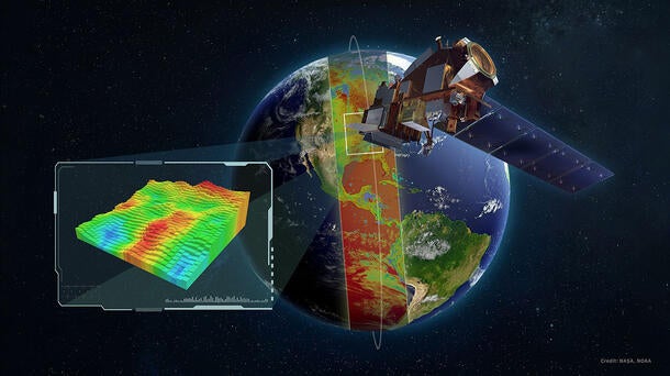
L3Harris just took one step further in helping NOAA advance its mission to provide more advanced, accurate weather forecasts that help save lives and protect property.
We recently completed electromagnetic interference (EMI) testing on our Cross-track Infrared Sounder (CrIS), a mission-critical weather observation instrument that will be used on the next spacecraft in NOAA’s Joint Polar Satellite System (JPSS) series. JPSS-4 is expected to launch in 2027, joining a fleet of satellites that circle the Earth 14 times a day providing sophisticated data on our atmosphere, oceans and landscape for seasonal, short- and long-term monitoring and forecasting.
CrIS is one of the world’s most advanced hyperspectral sounders and a key sensor used across the JPSS architecture. It observes more than 2,000 infrared channels to provide comprehensive temperature and moisture information that increases weather forecast accuracy worldwide. Its capabilities include:
- Tracking long-range smoke movement to help predict the impact of wildfires across the U.S.
- Improving rainfall predictions, enabling earlier flood warnings that help save lives and property.
- Pinpointing hurricane track and intensity, providing more time to plan and prepare.
Completion of EMI testing is a major milestone for JPSS-4’s CrIS instrument. It demonstrates the sounder is compatible with the challenging operational electromagnetic environment.
“Successfully completing Electromagnetic Interference testing validates the L3Harris-built CrIS instrument will perform as designed when riding with other instruments on the JPSS-4 satellite,” said Rob Mitrevski, Vice President and General Manager, Spectral Solutions, L3Harris. “Based on these test results and our long on-orbit history with these sounding instruments, we have high confidence in future performance of this CrIS instrument.”
Powering the Next Generation of Weather Satellites
L3Harris is moving with urgency to deliver next-generation weather solutions that advance the mission capabilities proven in our Advanced Baseline Imager (ABI), Cross-track Infrared Sounder (CrIS) and Geostationary Operational Environmental Satellite-R (GOES-R) ground heritage solutions to improve short- and long-range forecast accuracy and increase life-saving warning times globally. These innovative solutions include a next-generation GeoXO imager (GXI) and modernized GOES-R ground system for the U.S. and next-generation imaging and sounding technology for Japan – all awarded as part of the more than $1 billion in weather-related contracts L3Harris received last year.
Our weather instruments and ground systems are paving the way toward a safer, more weather-ready world. By providing highly accurate and more detailed information faster than ever, these innovative technologies improve forecasting accuracy and warning lead times, so people have more time to prepare for and remain protected against extreme weather.
Together, NOAA and NASA oversee the development, launch, testing and operation of all the satellites in the JPSS program. NOAA funds and manages the program, operations, and data products. On behalf of NOAA, NASA develops and builds the instruments, spacecraft, and ground system, and launches the satellites, which NOAA operates.
