Engaging Maritime Threats, Increasing Situational Awareness with EO/IR Solutions

New threats are arising at sea. Commercial vessels and U.S. and U.K. Naval destroyers have increasingly found themselves in active weapons engagement zones, with sailors being put under threat of attack within moments of notice. Recently, enemies have employed new tactics through the use of unmanned aerial vehicles, such as small drones, and close-range ballistic missile attacks, hampering major shipping routes in vital waterways. 

Central to enabling safe and unrestricted maritime trade around the world, the need to ensure security of ports, harbors and shipping lanes continues to emerge as an increasing challenge for commercial and military maritime operations. 

Whether it be the threat of attack by small surface vessels, divers or autonomous underwater vehicles (AUVs) from the sea or unmanned aerial vehicles (UAVs) and ground assault from ashore, maritime operations must be equipped with next-generation technologies capable of providing authorities with advanced warning and necessary levels of situational awareness (SA). 

Maritime Challenges: Ports, Harbors and the Global Supply Chain
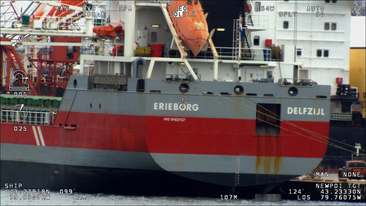
WESCAm 10-MS on Freighter Erieborg Delfzijl

According to NATO’s Center for Maritime Research and Experimentation (CMRE), both commercial and military ports and harbors can be difficult to protect due to their significant size, including unique environments with heavy sea- and land-based traffic and proximity to urban areas. The CMRE warns how the threat of attack can come from a variety of “small and hard-to-detect sources” which can complicate the task of port and vessel protection. 

“This complex environment makes it difficult to monitor ports for hostile intent and even more challenging to develop a response that is non-lethal to the many people who are at the port and who may live, work, and recreate in the surrounding area,” CMRE doctrine describes. 

Protective measures available to government agencies and port authorities include a layered approach, combing solutions for ground-breaking electro-optical and infrared (EO/IR) camera and radar solutions, cyber security, as well as command control (C2) software designed to network defensive capabilities into a Common Operating Picture (COP). These technologies, among others, must satisfy minimum standards for both onshore and offshore critical national infrastructure (CNI) as stipulated by the International Ship and Port Facility Security Code. 

According to the ISPS Code, government agencies and port authorities must be able to “detect security threats and take preventative measures against security incidents affecting port facilities used in international trade.”

The ISPS Code describes a series of escalating Maritime Security (MARSEC) levels, which include MARSEC Level 1 - the employment of surveillance equipment to monitor restricted areas; and MARSEC Level 2 - the employment of persistent surveillance technologies.

As a result, government agencies and port authorities around the world are identifying and investing in next-generation technologies to satisfy emerging port and harbor security requirements. These efforts not only cover the protection of critical port infrastructure from terrorism, but also enhanced maritime domain awareness, improved port-wide maritime security risk management, and the establishment and maintenance of maritime security mitigation protocols to support port recovery and resiliency capabilities.
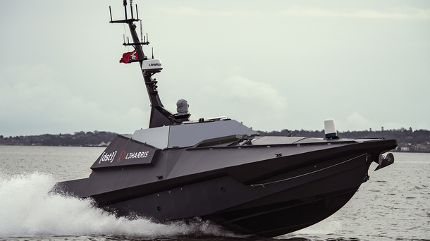
L3Harris Solutions

Advanced situational awareness in the maritime domain

Ensuring situational awareness across shore-based critical infrastructure including ports, harbors and other maritime entry points continues to be driven by recent events arising out of the contemporary operating environment. 

Emerging concepts of new operations, tactics, techniques and procedures of maritime security are requiring agencies to look at modern threats through a new lens. This includes the use of fixed and mobile situational awareness solutions comprising intelligence, surveillance, and reconnaissance systems networked to a command and control capability. Properly deployed, this kind of cross-functional approach allows for the rapid collection, collation and dissemination of information about emerging threats and ultimately for effective and dynamic action to be engaged. 

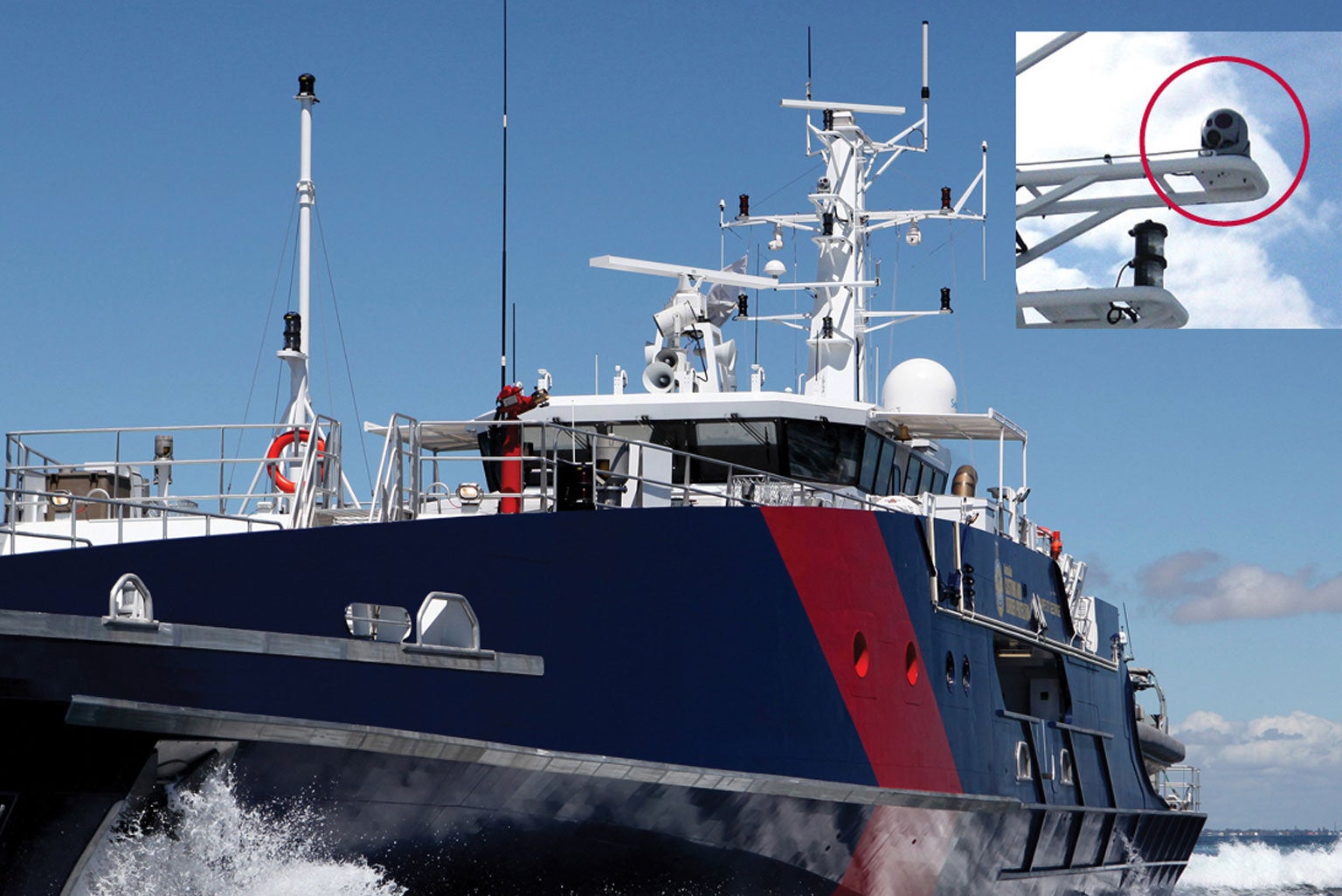
Designed and engineered for the maritime environment, L3Harris’ WESCAM MX-10 MS and WESCAM MX-15 MS maritime sensor systems’ unique capabilities make each ideally suited for the protection of surface vessels and critical infrastructure ashore, including ports, harbors and maritime entry points. 

The payloads of both systems comprise a fully-digital and high definition solution featuring a compact, multi-sensor and multi-spectral imaging system designed to conduct wide field-of-view coastal surveillance and threat detection missions from towers, rooftops and mobile platforms including autonomous surface vessels. 

Whether operating in a standalone capacity or as part of a networked system-of-systems approach, the WESCAM MX-10 MS and WESCAM MX-15 MS provide operators with a rugged solution, protected against wind, saltwater, high humidity levels and the general maritime environment. 

Having proven their ability to support the maritime security requirements of surface vessels, customers are now requiring sensors like the WESCAM MX-10 MS to integrate on fixed installations ashore to protect the CNI as well as docked surface vessels within the port or harbor itself. This application beyond traditional vessel integration highlights how maritime WESCAM MX™-Series sensors can assist commercial shipping agencies and port authorities in reducing security liabilities and insurance costs, in addition to mitigating new maritime threats such as piracy. 

Premium Maritime Capabilities 

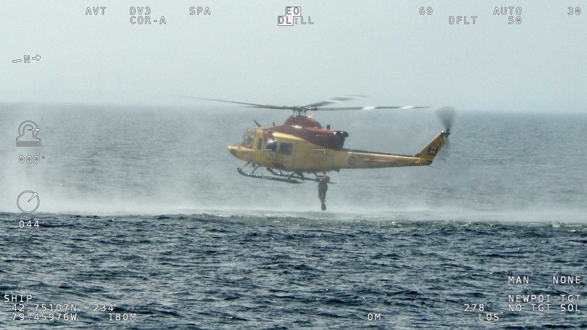
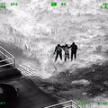
WESCAM MX-10MS Search and Rescue Mission

L3Harris’ next-generation WESCAM MX-10 MS features a multi-spectral, multi-sensor payload suite that provides superior imaging under a wide range of illumination and atmospheric maritime conditions. A high-definition (HD) thermal image provides the ability to see targets and threats under low and no-light conditions and provides high-target contrast in the day. A wide-angle HD color day camera provides surveillance, situational awareness and target detection capability while a narrow-angle camera provides long-range target recognition and identification capability. The imagers are supported by a gimbal that provides a full 360-degree field-of-regard and automatic scanning functions, reducing operator workload. 

Stabilization performance is essential to optical range performance. The 4-axis architecture separates the inner axis, which performs the fast and fine motion required for superior range performance, from the outer axis, which provides sealing from the outside environment. The internal passive isolator protects the optical bench from shock, enabling increased reliability and maximizing operational availability. 

Further, the WESCAM MX-10 MS and WESCAM MX-15 MS leverage L3Harris’ investment in high-end imaging systems by providing state-of-the-art features that significantly reduce operator workload, allowing operators to focus on the target and mission, versus the equipment. An internal inertial navigation system, consisting of an embedded GPS and inertial measurement unit couple with an internal laser rangefinder, provide accurate and stable target geo-location. Both marinized EO/IR systems also feature advanced image processing algorithms, a robust automatic video tracker and multi-target tracker as well as high-performance image blending. 

System-of-Systems Approach

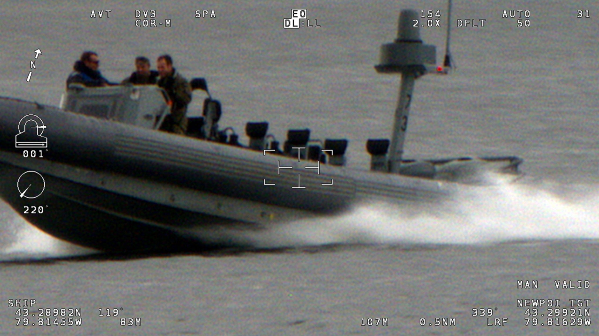
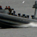
WESCAM MX-10MS Surveillance Mission

As the current maritime threat environment continues to evolve and grow increasingly complex and unpredictable, government and commercial customers are demanding system-of-systems approaches capable of integrating a series of modular and evolving technologies to support the security requirements of ports, harbors, maritime entry points and surface vessels. This includes the integration of radar and L3Harris WESCAM MX-Series maritime EO/IR sensors as well as kinetic and non-kinetic effectors, which can network together into a seamless COP structure, also benefiting from upgrades in cyber security software, artificial intelligence and machine learning algorithms to streamline decision-making processes. This approach allows a central C2 battle management system to ‘slew and cue’ multiple networked payloads following the identification by the WESCAM MX-10 MS or WESCAM MX-15 MS of threats in the air, land or sea. The concept of operations extends to include WESCAM MX-Series sensors integrated aboard L3Harris UAVs, USVs, and AUVs, providing an additional layer in mobile intelligence-gathering capabilities within the COP.

L3Harris is uniquely positioned to support the emerging demand and challenges facing government and commercial customers in the maritime sector. Specializing in EO/IR imaging systems, radar technology, public safety and military-grade tactical communications, as well as C2 software and analytical instrumentation, L3Harris stands ready to integrate WESCAM MX-10 MS and WESCAM MX-15 MS sensors and a distributed system-of-systems approach into existing infrastructure. 

Related News

L3Harris and Palantir logos

Press release | 10. 23. 2024

L3Harris and Palantir Announce Strategic Partnership

L3Harris Technologies and Palantir Technologies Inc. today announced a strategic partnership to propel advanced technology development and accelerate L3Harris’ digital transformation.

L3Harris and Palantir logos

Press release | 10. 23. 2024

L3Harris and Palantir Announce Strategic Partnership

WESCAM MX™-20 on a fixed wing aircraft

Editorial | 10. 14. 2024

L3Harris and Palantir Demonstrate Successful Integration of New AI/ML Capabilities

Living in Europa

Editorial | 10. 15. 2024

Living in Europa

Sky Guardian

Editorial | 10. 10. 2024

Next-Generation EO/IR Uncrewed and Autonomous Vehicle Integration

L3Harris WESCAM Authorized Customer Care Center

Editorial | 09. 09. 2024

Local Presence. Regional Sustainment.